Approximate length of route: 2.5 hours (one way).
The path starts beside Santo Lourenzo’s Chapel, at the peak of the Village. It’s a wide and well defined track by which tractors and off-road vehicles circulate (only for agriculture and ranching, and for watching the hunting reserve. Because of that,it’s protected by a gate).
We continue walking calmly and go through several beautiful fields: El Campo, El Chao Grande, Campo Redondo, the Mallar (where there are remainders of a shepherds’ cabin). After passing through the Mallar and go across the river, we can see along its whole legnth the Piornedo’s Meadow,a large glacier cirque surrounded by mountains or hills: at the southeast, there is the Meixón Vella (where there are still remainders of the straps and the cabins built buy the Extremaduran and the Castilian people, who came with their flocks of sheeps and goats to these lands until the late nineteenth century), and the Lanza and Mustallar Peaks, with the Portelín Rock; at the northwest there is Pena Larga, and in the middle of these two peaks, there is the Porto Peak, where the Burbia path starts.
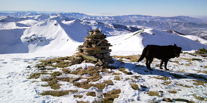
The ascent to Mustallar is a little hard, the best you can do is going to the Porto Peak and, from there, help yourself with the wire fence that goes until the peak (made by the locals so that cows do not fall off the cliffs).
At the top, we’ll realize that the effort was well worth.
This route can have many variants, from the Meadow we can go to Pena Larga (and approach to Cuina) or we can climb up to Lanza Peak, continue along the crest until Tres Obispos, pass by Villous (behind Mustallar) or even make a long route to Burbia (more than 5 hours away, one way, through the Porto Peak or through the Abiduliña or Villous).
